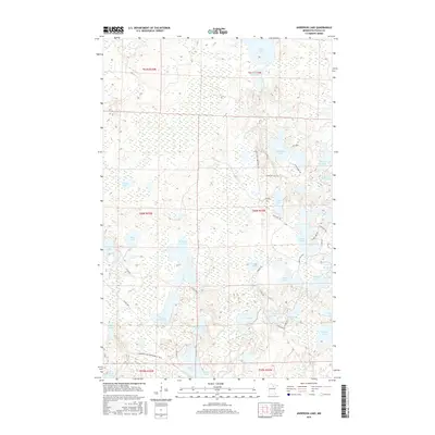
2016 Map of Anderson Lake
USGS Topo · Published 2016About this map
The W Fork Prairie River meanders through this heavily glaciated pocket of northern Minnesota, defining a landscape dominated by interconnected wetlands and dozens of small basins. This 2016 survey highlights a region largely set aside for recreation and resource management, where seasonal access is provided by specialized routes like the Cameron Lake Snowmobile Trail and the Lost Lake Truck Trl. Named water bodies such as Brush Shanty Lake, Little Antler Lake, and Raddison Lake are interspersed among unnamed marshlands, illustrating the complex hydrography typical of the North Woods. Human infrastructure is limited to secondary roads and trails, including Scenic Hwy and Owen Lake Rd, which thread between the lakes. This configuration suggests a landscape shaped by timber interests and outdoor tourism, where traditional land divisions like t60n r24w dictate the sparse development patterns seen near Anderson Lake.
Find a feature on this map
51 named features on this map. Tap any name to fly to it.
Don’t see what you’re looking for? This feature index may not catch every label — zoom into the map to look around manually.
Map Details
Editions of this 2016 Anderson Lake Map
This is the sole edition of this map. No revisions or reprints were ever made.
Other maps of this area

1919 · Release
USGS Topo · 1:62,500

1919 · Marcell
USGS Topo · 1:62,500

1943 · Release
USGS Topo · 1:62,500

1954 · Hibbing
USGS Topo · 1:250,000

1957 · Hibbing
USGS Topo · 1:250,000

1958 · Hibbing
USGS Topo · 1:250,000

1964 · Hibbing
USGS Topo · 1:250,000

1970 · Clubhouse Lake
USGS Topo · 1:24,000

1970 · Coon Lake
USGS Topo · 1:24,000

1970 · Deer Lake East
USGS Topo · 1:24,000