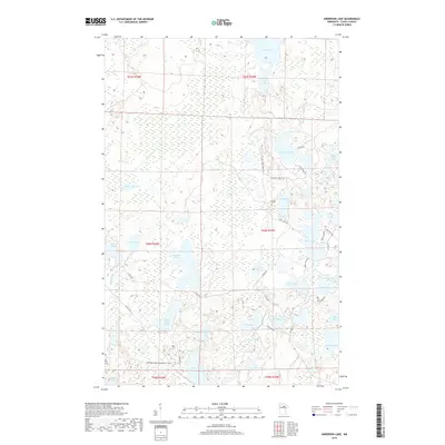
2019 Map of Anderson Lake
USGS Topo · Published 2019About this map
Glacial lakes and marshy lowlands dominate this corner of Itasca County, where the W Fork Prairie River meanders through a dense network of water bodies. The landscape is defined by the proximity of Anderson Lake and Owen Lake, which are interconnected by a system of rural routes and forest tracks like the Lost Lake Truck Trl and Otter Ridge Trl. This area is characterized by its transition from open water to seasonal wetlands, particularly around Brush Shanty Lake and Little Antler Lake. Recreational infrastructure is evident through the presence of the Cameron Lake Snowmobile Trail and segments of the Scenic Hwy, reflecting the region's importance for north-woods outdoor access. The map reveals a remote, water-rich interior where small roads like Perkins Rd and Zigs Rd provide the only land access to secluded shores.
Find a feature on this map
49 named features on this map. Tap any name to fly to it.
Don’t see what you’re looking for? This feature index may not catch every label — zoom into the map to look around manually.
Map Details
Editions of this 2019 Anderson Lake Map
This is the sole edition of this map. No revisions or reprints were ever made.
Other maps of this area

1919 · Release
USGS Topo · 1:62,500

1919 · Marcell
USGS Topo · 1:62,500

1943 · Release
USGS Topo · 1:62,500

1954 · Hibbing
USGS Topo · 1:250,000

1957 · Hibbing
USGS Topo · 1:250,000

1958 · Hibbing
USGS Topo · 1:250,000

1964 · Hibbing
USGS Topo · 1:250,000

1970 · Clubhouse Lake
USGS Topo · 1:24,000

1970 · Coon Lake
USGS Topo · 1:24,000

1970 · Deer Lake East
USGS Topo · 1:24,000