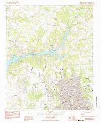
1983 Map of Anderson North
USGS Topo · Published 1983About this map
The growing city of Anderson and its northern suburban reaches are documented here during a period of significant expansion in the early 1980s. The landscape is defined by the branching waters of Hartwell Lake, which created a complex shoreline that transformed former farmland into recreational areas like the City of Anderson Recreation Area and Wistagoman (Girl Scout Camp). The city's institutional footprint is clear, featuring Anderson College, St Marys Hosp, and the Anderson County Airport.
Find a feature on this map
66 named features on this map. Tap any name to fly to it.
Don’t see what you’re looking for? This feature index may not catch every label — zoom into the map to look around manually.
Map Details
Editions of this 1983 Anderson North Map
2 editions found
Other maps of this area

1888 · Pickens
USGS Topo · 1:125,000

1893 · Elberton
USGS Topo · 1:125,000

1894 · Pickens
USGS Topo · 1:125,000

1950 · La France
USGS Topo · 1:24,000

1951 · La France
USGS Topo · 1:24,000

1951 · Clemson
USGS Topo · 1:24,000

1954 · Greenville
USGS Topo · 1:250,000

1957 · Anderson
USGS Topo · 1:62,500

1958 · Greenville
USGS Topo · 1:250,000

1959 · Hartwell NE
USGS Topo · 1:24,000