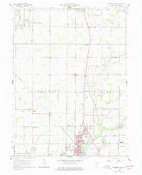
1960 Map of Anderson North
USGS Topo · Published 1978About this map
The agrarian and industrial landscape of Madison County is documented here at the start of the 1960s, showing the northward expansion of Anderson and the established rural patterns of Monroe, Lafayette, and Richland townships. The map records several small settlements and community hubs, including Linwood, Prosperity, and Florida, which are linked by a network of drainage ways such as Killbuck Creek and Pipe Creek.
Find a feature on this map
53 named features on this map. Tap any name to fly to it.
Don’t see what you’re looking for? This feature index may not catch every label — zoom into the map to look around manually.
Map Details
Editions of this 1960 Anderson North Map
5 editions found
Other maps of this area

1952 · Anderson
USGS Topo · 1:24,000

1953 · Lapel
USGS Topo · 1:24,000

1953 · Muncie
USGS Topo · 1:250,000

1956 · Muncie
USGS Topo · 1:250,000

1960 · Gilman
USGS Topo · 1:24,000

1960 · Elwood
USGS Topo · 1:24,000

1960 · Middletown
USGS Topo · 1:24,000

1960 · Alexandria
USGS Topo · 1:24,000

1960 · Gaston
USGS Topo · 1:24,000

1960 · Anderson North
USGS Topo · 1:24,000