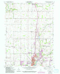
1960 Map of Anderson North
USGS Topo · Published 1994About this map
Alexandria and the northern outskirts of Anderson anchor this mid-century Indiana landscape, illustrating the transition from dense municipal centers to the agricultural townships of Monroe, Lafayette, and Richland. Between these urban hubs, small crossroads communities like Linwood and Prosperity dot the grid of rural routes, which include 1000 North Road and 500 North Road. The map reveals a drainage system defined by Killbuck Creek and Pipe Creek, with numerous smaller runs such as Lucky Run and Knopp Run cutting through the farmland.
Find a feature on this map
55 named features on this map. Tap any name to fly to it.
Don’t see what you’re looking for? This feature index may not catch every label — zoom into the map to look around manually.
Map Details
Editions of this 1960 Anderson North Map
5 editions found
Other maps of this area

1952 · Anderson
USGS Topo · 1:24,000

1953 · Lapel
USGS Topo · 1:24,000

1953 · Muncie
USGS Topo · 1:250,000

1956 · Muncie
USGS Topo · 1:250,000

1960 · Gilman
USGS Topo · 1:24,000

1960 · Elwood
USGS Topo · 1:24,000

1960 · Middletown
USGS Topo · 1:24,000

1960 · Alexandria
USGS Topo · 1:24,000

1960 · Gaston
USGS Topo · 1:24,000

1960 · Anderson North
USGS Topo · 1:24,000