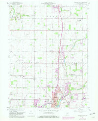
1960 Map of Anderson North
USGS Topo · Published 1982About this map
Anderson and its northern suburbs are captured in a period of northward expansion along the Conrail line and Killbuck Creek. The landscape transitions from the urban density of North Anderson and the industrial layout of the U S Naval Reserve Training Center to the agricultural reaches of Monroe and Lafayette townships. Scattered rural communities such as Linwood, Prosperity, and Florida serve as local hubs, anchored by neighborhood landmarks like Leach Sch and the College Corner Sch. This era is defined by the intersection of traditional family farming and the mid-century rise of car-centric infrastructure, evidenced by the Drive-In Theater and specialized airstrips like Jessup Airport. For local historians and genealogists, the map preserves the locations of numerous country churches and burial grounds, including Elm Grove Ch, Bailey Chapel, and the Wesley Chapel Cem, which reflect the area's early settlement patterns along waterways like Pipe Creek and Little Killbuck Creek.
Find a feature on this map
49 named features on this map. Tap any name to fly to it.
Don’t see what you’re looking for? This feature index may not catch every label — zoom into the map to look around manually.
Map Details
Editions of this 1960 Anderson North Map
5 editions found
Other maps of this area

1952 · Anderson
USGS Topo · 1:24,000

1953 · Lapel
USGS Topo · 1:24,000

1953 · Muncie
USGS Topo · 1:250,000

1956 · Muncie
USGS Topo · 1:250,000

1960 · Gilman
USGS Topo · 1:24,000

1960 · Elwood
USGS Topo · 1:24,000

1960 · Middletown
USGS Topo · 1:24,000

1960 · Alexandria
USGS Topo · 1:24,000

1960 · Gaston
USGS Topo · 1:24,000

1960 · Anderson North
USGS Topo · 1:24,000