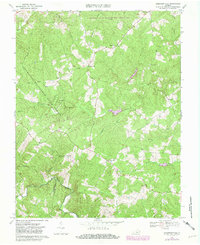
1967 Map of Andersonville
USGS Topo · Published 1981About this map
Andersonville and New Store anchor this central Virginia landscape, which is defined by the convergence of several major timber and wildlife preserves. The area showcases a dense network of watercourses including the Willis River, Slate River, and the Appomattox River along the southern border. Public lands such as the Appomattox-Buckingham State Forest and the Horsepen State Wildlife Management Area dominate the topography, reflecting the region's historical reliance on forestry and conservation. Small rural congregations are central to the local geography, with numerous historic houses of worship like First Liberty Ch, Second Liberty Ch, and Chestnut Grove Ch scattered across the upland ridges. Settlement patterns follow the winding secondary roads that connect isolated communities like Enonville and Arcanum, providing a clear record of the mid-century Piedmont rural structure.
Find a feature on this map
32 named features on this map. Tap any name to fly to it.
Don’t see what you’re looking for? This feature index may not catch every label — zoom into the map to look around manually.
Map Details
Editions of this 1967 Andersonville Map

Other maps of this area

1891 · Palmyra
USGS Topo · 1:125,000

1891 · Farmville
USGS Topo · 1:125,000

1892 · Buckingham
USGS Topo · 1:125,000

1892 · Appomattox
USGS Topo · 1:125,000

1893 · Farmville
USGS Topo · 1:125,000

1895 · Palmyra
USGS Topo · 1:125,000

1897 · Palmyra
USGS Topo · 1:125,000

1947 · Roanoke
USGS Topo · 1:250,000

1950 · Dillwyn
USGS Topo · 1:62,500

1958 · Farmville
USGS Topo · 1:62,500