
1947 Map of Angola East
USGS Topo · Published 1947About this map
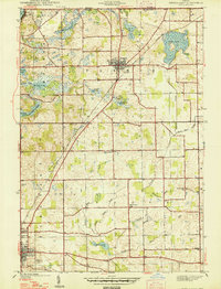
Glacial lakes and drainage ditches define this pocket of Northeast Indiana just south of the Michigan border in the late 1930s. The town of Fremont serves as a northern anchor, where the New York Central railroad cuts a diagonal path toward the southeast. To the south, the city of Angola sits at the edge of the survey, surrounded by rural landmarks like Circle Hill Cem.
Find a feature on this map
39 named features on this map. Tap any name to fly to it.
Don’t see what you’re looking for? This feature index may not catch every label — zoom into the map to look around manually.
Map Details
Editions of this 1947 Angola East Map
2 editions found
Other maps of this area

1939 · Hamilton
USGS Topo · 1:24,000

1939 · Angola East
USGS Topo · 1:24,000

1939 · Clear Lake
USGS Topo · 1:24,000

1940 · Metz
USGS Topo · 1:24,000

1940 · Clear Lake
USGS Topo · 1:24,000

1941 · Angola West
USGS Topo · 1:24,000

1942 · Ashley
USGS Topo · 1:24,000

1942 · Angola West
USGS Topo · 1:24,000

1948 · Hamilton
USGS Topo · 1:24,000

1953 · Fort Wayne
USGS Topo · 1:250,000