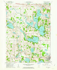
1960 Map of Angola West
USGS Topo · Published 1963About this map
The glacial lakes of Steuben County dominate this landscape at the dawn of the 1960s, showing a region defined by recreational development and historic small-town clusters. Lake James is the centerpiece, featuring the Pokagon State Park along its eastern shore, complete with the Potawatomi Inn and various organized camps like Boys Camp and Girls Camp. The mapping reveals the transition from early industrial and agricultural sites, such as Nevada Mills and Flint, to a landscape of leisure and education. Near the city of Angola, Tri-State College and the Tri-State Airport mark the area's growth as a local hub. Rural life is anchored by family-named landmarks and resting places, including Jamestown Cem and Crockett Cem, while the construction of the Toll Road in the north indicates the shifting transportation patterns of the mid-century.
Find a feature on this map
88 named features on this map. Tap any name to fly to it.
Don’t see what you’re looking for? This feature index may not catch every label — zoom into the map to look around manually.
Map Details
Editions of this 1960 Angola West Map
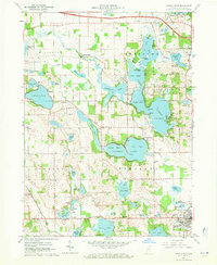
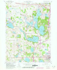
Other maps of this area

1939 · Hamilton
USGS Topo · 1:24,000

1939 · Angola East
USGS Topo · 1:24,000

1940 · Orland
USGS Topo · 1:24,000

1941 · Orland
USGS Topo · 1:24,000

1941 · Angola West
USGS Topo · 1:24,000

1942 · Ashley
USGS Topo · 1:24,000

1942 · Angola West
USGS Topo · 1:24,000

1942 · Stroh
USGS Topo · 1:24,000

1947 · Angola East
USGS Topo · 1:24,000

1948 · Hamilton
USGS Topo · 1:24,000