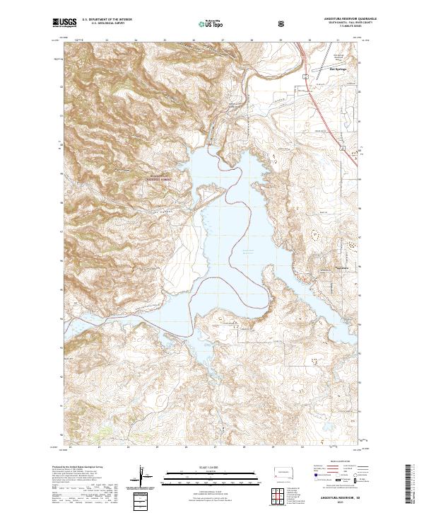
2021 Map of Angostura Reservoir
USGS Topo · Published 2021About this map
Angostura Reservoir dominates this South Dakota landscape, where the waters of the Cheyenne River are impounded within a complex geography of rugged draws and canyons. The western reaches extend into the Black Hills National Forest, a terrain marked by steep features like Tepee Mtn and the winding Sheps Canyon. The map reveals a transition from the protected forest lands to the recreational and residential developments clustered near the community of Angostura.
Find a feature on this map
50 named features on this map. Tap any name to fly to it.
Don’t see what you’re looking for? This feature index may not catch every label — zoom into the map to look around manually.
Map Details
Editions of this 2021 Angostura Reservoir Map
This is the sole edition of this map. No revisions or reprints were ever made.
Other maps of this area

1896 · Oelrichs
USGS Topo · 1:125,000

1900 · Oelrichs
USGS Topo · 1:125,000

1902 · Edgemont
USGS Topo · 1:125,000

1950 · Hot Springs
USGS Topo · 1:24,000

1950 · Buffalo Gap
USGS Topo · 1:24,000

1950 · Heppner
USGS Topo · 1:24,000

1950 · Cascade Springs
USGS Topo · 1:24,000

1950 · Hot Springs SE
USGS Topo · 1:24,000

1950 · Angostura Reservoir
USGS Topo · 1:24,000

1951 · Minnekahta NE
USGS Topo · 1:24,000