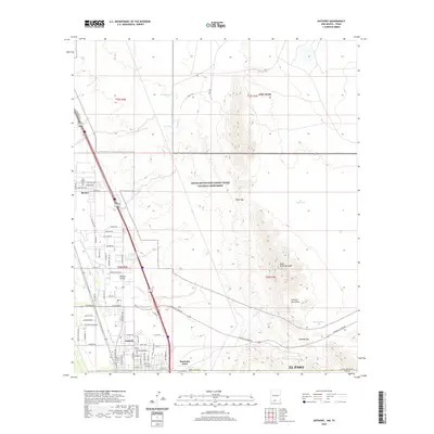
2020 Map of Anthony
USGS Topo · Published 2020About this map
Anthony and Berino anchor the western edge of this desert landscape, situated within the fertile Mesilla Valley where the Anthony Lateral canal supports local agriculture. The transition from the valley floor to the high desert is marked by the sprawling Organ Mountains-Desert Peaks National Monument and the rugged northern reaches of the Franklin Mountains. Notable landmarks like North Anthonys Nose and Webb Gap define the skyline above the military lands of Fort Bliss. Genealogists may find interest in the location of the Old Berino Cem near the town center, while water management for ranching and agriculture is evidenced by several named reservoirs, including Beech Tank and Berino Tank, dotting the arid terrain toward Anthony Gap.
Find a feature on this map
79 named features on this map. Tap any name to fly to it.
Don’t see what you’re looking for? This feature index may not catch every label — zoom into the map to look around manually.
Map Details
Editions of this 2020 Anthony Map
This is the sole edition of this map. No revisions or reprints were ever made.
Other maps of this area

1891 · Las Cruces
USGS Topo · 1:125,000

1893 · Las Cruces
USGS Topo · 1:125,000

1896 · El Paso
USGS Topo · 1:125,000

1908 · El Paso
USGS Topo · 1:125,000

1917 · Canutillo
USGS Topo · 1:62,500

1919 · Canutillo
USGS Topo · 1:62,500

1940 · Newman
USGS Topo · 1:62,500

1942 · Fort Bliss
USGS Topo · 1:62,500

1943 · La Mesa
USGS Topo · 1:62,500

1943 · Newman
USGS Topo · 1:62,500