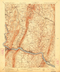
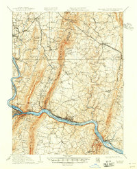
1910 Map of Antietam
USGS Topo · Published 1923About this map
Sharpsburg and its surrounding countryside reflect a landscape heavily defined by its Civil War heritage and the industrial corridors of the early twentieth century. West of the South Mountain range, the map detail encompasses the historic grounds of Bloody Lane, the Dunkard Church, and Burnside Bridge along Antietam Creek. These landmarks of the 1862 conflict sit amidst a developing network of turnpikes like the Boonsboro Pike and early rail lines, including the Washington County Br and the Hagerstown and Frederick Electric Ry.
Find a feature on this map
98 named features on this map. Tap any name to fly to it.
Don’t see what you’re looking for? This feature index may not catch every label — zoom into the map to look around manually.
Map Details
Editions of this 1910 Antietam Map
6 editions found

Other maps of this area

1884 · Harpers Ferry
USGS Topo · 1:125,000

1891 · Harpers Ferry
USGS Topo · 1:125,000

1893 · Frederick
USGS Topo · 1:125,000

1893 · Harpers Ferry
USGS Topo · 1:125,000

1894 · Frederick
USGS Topo · 1:125,000

1908 · Middletown
USGS Topo · 1:48,000

1908 · Seneca
USGS Topo · 1:62,500

1908 · Ijamsville
USGS Topo · 1:62,500

1909 · Ijamsville
USGS Topo · 1:62,500

1909 · Hagerstown
USGS Topo · 1:48,000