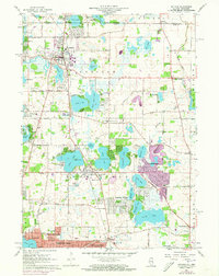
1960 Map of Antioch
USGS Topo · Published 1973About this map
Antioch serves as the focal point of this northern Illinois survey, where the Soo Line railroad connects scattered lakefront communities. The landscape is defined by an intricate network of glacial lakes including Loon Lake, Cedar Lake, and Deep Lake, which supported early 20th-century recreational development. Significant institutional footprints are visible at St Benedicts Abbey and the Allendale Farm Sch near Lake Villa.
Find a feature on this map
99 named features on this map. Tap any name to fly to it.
Don’t see what you’re looking for? This feature index may not catch every label — zoom into the map to look around manually.
Map Details
Editions of this 1960 Antioch Map
3 editions found
Other maps of this area

1892 · Racine
USGS Topo · 1:62,500

1893 · Silver Lake
USGS Topo · 1:62,500

1905 · Racine
USGS Topo · 1:62,500

1906 · Silver Lake
USGS Topo · 1:62,500

1906 · Waukegan
USGS Topo · 1:62,500

1908 · Waukegan
USGS Topo · 1:62,500

1920 · Grays Lake
USGS Topo · 1:62,500

1923 · Grays Lake
USGS Topo · 1:62,500

1954 · Rockford
USGS Topo · 1:250,000

1955 · Rockford
USGS Topo · 1:250,000