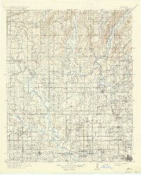
1912 Map of Antlers
USGS Topo · Published 1937About this map
Antlers stands as a central hub in southeastern Oklahoma, situated at the confluence of the Kiamichi River and Beaver Creek during this era of early statehood. The landscape is defined by the heavy presence of local infrastructure, from the Asphalt Mines in the northwest to the numerous rural education centers like Armstrong School and Nelson Chapel School. The St. Louis and San Francisco railroad dictates the settlement pattern, connecting towns such as Kosoma, Moyers, and Hugo while bypassing smaller outposts like Niles Store.
Find a feature on this map
93 named features on this map. Tap any name to fly to it.
Don’t see what you’re looking for? This feature index may not catch every label — zoom into the map to look around manually.
Map Details
Editions of this 1912 Antlers Map
3 editions found

Other maps of this area

1896 · Coalgate
USGS Topo · 1:125,000

1898 · McAlester
USGS Topo · 1:125,000

1899 · Coalgate
USGS Topo · 1:125,000

1899 · Atoka
USGS Topo · 1:125,000

1900 · Atoka
USGS Topo · 1:125,000

1900 · Coalgate
USGS Topo · 1:125,000

1901 · Antlers
USGS Topo · 1:125,000

1901 · Tuskahoma
USGS Topo · 1:125,000

1901 · Alikchi
USGS Topo · 1:125,000

1903 · Paris
USGS Topo · 1:125,000