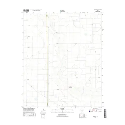
2016 Map of Anton NE
USGS Topo · Published 2016About this map
Blackwater Draw cuts across this High Plains landscape, marking a prominent natural drainage feature in a region defined by agricultural grid patterns. The terrain is dotted with numerous small depressions and playas, including the named Givens Lake, which serve as critical catchments in this semi-arid environment. The boundary between Lamb Co and Hale Co runs vertically through the western portion of the sheet, dividing the administrative reaches of these two Texas Panhandle counties. A dense network of rural roads, such as Corral Rd and Amigo Rd, follows the section lines of the survey system, reflecting the systematic land division that has shaped the area’s ranching and farming history. While large settlements are absent on this specific quadrangle, the placement of Farm to Market roads like Fm 54 and Fm 37 indicates the vital transportation corridors connecting local producers to regional hubs.
Find a feature on this map
30 named features on this map. Tap any name to fly to it.
Don’t see what you’re looking for? This feature index may not catch every label — zoom into the map to look around manually.
Map Details
Editions of this 2016 Anton NE Map
This is the sole edition of this map. No revisions or reprints were ever made.
Other maps of this area

1954 · Lubbock
USGS Topo · 1:250,000

1954 · Plainview
USGS Topo · 1:250,000

1954 · Clovis
USGS Topo · 1:250,000

1954 · Brownfield
USGS Topo · 1:250,000

1957 · Anton
USGS Topo · 1:62,500

1957 · Abernathy
USGS Topo · 1:62,500

1958 · Brownfield
USGS Topo · 1:250,000

1958 · Clovis
USGS Topo · 1:250,000

1958 · Plainview
USGS Topo · 1:250,000

1962 · Brownfield
USGS Topo · 1:250,000