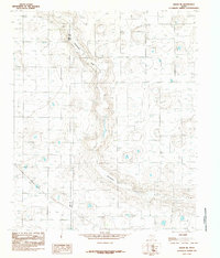
1985 Map of Anton NE
USGS Topo · Published 1985About this map
Blackwater Draw cuts a significant path through the Llano Estacado landscape of the Texas Panhandle, defining the local topography and drainage patterns. This 1985 provisional survey captures the agricultural and industrial infrastructure of the region during the mid-1980s, marked by a dense network of water wells and irrigation features. The map documents the political boundary between Lamb Co and Hale Co, providing a clear record of land division in this intensive farming belt. Beyond the natural drainage of the draw, the map identifies specific utilities such as the Trans-line Wooden H-frame power infrastructure, which supported the rural development of the era. For researchers, the sheer density of labeled wells illustrates the heavy reliance on the Ogallala Aquifer to sustain the High Plains economy during this period.
Find a feature on this map
3 named features on this map. Tap any name to fly to it.
Don’t see what you’re looking for? This feature index may not catch every label — zoom into the map to look around manually.
Map Details
Editions of this 1985 Anton NE Map
This is the sole edition of this map. No revisions or reprints were ever made.
Other maps of this area

1954 · Lubbock
USGS Topo · 1:250,000

1954 · Plainview
USGS Topo · 1:250,000

1954 · Clovis
USGS Topo · 1:250,000

1954 · Brownfield
USGS Topo · 1:250,000

1957 · Anton
USGS Topo · 1:62,500

1957 · Abernathy
USGS Topo · 1:62,500

1958 · Brownfield
USGS Topo · 1:250,000

1958 · Clovis
USGS Topo · 1:250,000

1958 · Plainview
USGS Topo · 1:250,000

1962 · Brownfield
USGS Topo · 1:250,000