
Loading...
Loading map...1892 Map of Appomattox
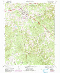
USGS Topo · Published 1945About this map
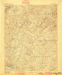
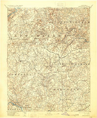
Appomattox Court House National Historical Monument anchors this late 19th-century survey of Central Virginia, a region defined by its role in the final days of the Civil War. The landscape is heavily dissected by the headwaters of the James River to the north and the Roanoke River to the south. At the time of this reconnaissance survey by A. E. Murlin and Chas. E. Cooke, the area was a network of small agricultural hubs like Red House, Evergreen, and Madisonville, connected by the Norfolk and Western Railroad.
Find a feature on this map
63 named features on this map. Tap any name to fly to it.
Don’t see what you’re looking for? This feature index may not catch every label — zoom into the map to look around manually.
Map Details
Date Portrayed1892
Date Published1945
PublisherU.S. Geological Survey
Map TypeTopographic
Scale1:125,000
Physical Dimensions16.97 x 20.8 inches
Editions of this 1892 Appomattox Map
6 editions found


Historical Maps of Appomattox Through Time
5 maps found


Featured Locations
Source Details
SourceU.S. Geological Survey
CopyrightPublic Domain