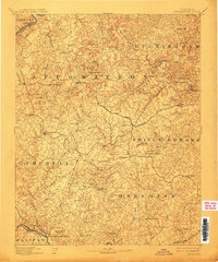
1892 Map of Appomattox
USGS Topo · Published 1912About this map
Appomattox and its surrounding counties are documented here just before the turn of the century, revealing a landscape defined by small crossroad settlements and river-based commerce. The southern portion of the map identifies the Grave of Patrick Henry near the Roanoke River, a significant site for local history and genealogy. This survey captures the rural infrastructure of the era, showing numerous fords and bridges such as Beasleys Ford and Venables Bridge crossing the Appomattox River.
Find a feature on this map
71 named features on this map. Tap any name to fly to it.
Don’t see what you’re looking for? This feature index may not catch every label — zoom into the map to look around manually.
Map Details
Editions of this 1892 Appomattox Map
6 editions found


Other maps of this area

1891 · Palmyra
USGS Topo · 1:125,000

1891 · Farmville
USGS Topo · 1:125,000

1892 · Lynchburg
USGS Topo · 1:125,000

1892 · Buckingham
USGS Topo · 1:125,000

1892 · Appomattox
USGS Topo · 1:125,000

1893 · Farmville
USGS Topo · 1:125,000

1894 · Lexington
USGS Topo · 1:125,000

1895 · Palmyra
USGS Topo · 1:125,000

1897 · Palmyra
USGS Topo · 1:125,000

1935 · Amherst
USGS Topo · 1:48,000