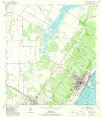
1954 Map of Aransas Pass
USGS Topo · Published 1966About this map
Live Oak Ridge forms the topographical spine of this coastal landscape, where the growing street grids of Aransas Pass and Ingleside meet the industrial energy of the mid-century Texas Gulf Coast. The map reveals a region defined by its transit corridors, from the Texas and New Orleans (Southern Pacific) railroad to the critical shipping lanes of the Intracoastal Waterway and Aransas Pass Channel.
Find a feature on this map
35 named features on this map. Tap any name to fly to it.
Don’t see what you’re looking for? This feature index may not catch every label — zoom into the map to look around manually.
Map Details
Editions of this 1954 Aransas Pass Map
2 editions found
Other maps of this area

1925 · Aransas Pass
USGS Topo · 1:62,500

1925 · Corpus Christi
USGS Topo · 1:62,500

1950 · Corpus Christi
USGS Topo · 1:250,000

1951 · Portland
USGS Topo · 1:24,000

1951 · Corpus Christi
USGS Topo · 1:62,500

1953 · Beeville
USGS Topo · 1:250,000

1954 · Rockport
USGS Topo · 1:62,500

1954 · Aransas Pass
USGS Topo · 1:24,000

1954 · Port Ingleside
USGS Topo · 1:24,000

1954 · Woodsboro
USGS Topo · 1:62,500