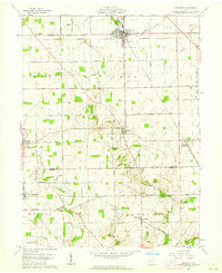
1961 Map of Arcanum
USGS Topo · Published 1963About this map
The agricultural landscape of Butler, Twin, Monroe, and Harrison townships unfolds across this early 1960s survey. The village of Arcanum serves as a primary hub, centered at the junction of the New York Central railroad and a local waterworks, with Ivester Park providing a community landmark. A dense network of rural roads like Dull Road and Otterbein Ithaca Road connects smaller settlements and farming hamlets, including Castine, Gordon, and West Manchester.
Find a feature on this map
39 named features on this map. Tap any name to fly to it.
Don’t see what you’re looking for? This feature index may not catch every label — zoom into the map to look around manually.
Map Details
Editions of this 1961 Arcanum Map
2 editions found
Other maps of this area

1905 · Brookville
USGS Topo · 1:62,500

1911 · Covington
USGS Topo · 1:62,500

1944 · Covington
USGS Topo · 1:62,500

1953 · Cincinnati
USGS Topo · 1:250,000

1953 · Muncie
USGS Topo · 1:250,000

1956 · Muncie
USGS Topo · 1:250,000

1957 · Cincinnati
USGS Topo · 1:250,000

1960 · New Madison
USGS Topo · 1:24,000
1960 · Eaton North
USGS Topo · 1:24,000

1961 · Laura
USGS Topo · 1:24,000