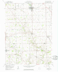
1961 Map of Arcanum
USGS Topo · Published 1985About this map
The agrarian landscape of southern Darke County and northern Preble County is defined by its early rail connectivity and small village centers during the mid-century. Arcanum serves as the primary hub, where the New York Central railroad intersects the community near Ivester Park and the local Waterworks. Further south, the Pennsylvania line crosses through West Manchester, illustrating the vital role of rail transport in moving goods from these Ohio farmsteads.
Find a feature on this map
36 named features on this map. Tap any name to fly to it.
Don’t see what you’re looking for? This feature index may not catch every label — zoom into the map to look around manually.
Map Details
Editions of this 1961 Arcanum Map
2 editions found
Other maps of this area

1905 · Brookville
USGS Topo · 1:62,500

1911 · Covington
USGS Topo · 1:62,500

1944 · Covington
USGS Topo · 1:62,500

1953 · Cincinnati
USGS Topo · 1:250,000

1953 · Muncie
USGS Topo · 1:250,000

1956 · Muncie
USGS Topo · 1:250,000

1957 · Cincinnati
USGS Topo · 1:250,000

1960 · New Madison
USGS Topo · 1:24,000
1960 · Eaton North
USGS Topo · 1:24,000

1961 · Laura
USGS Topo · 1:24,000