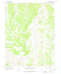
1968 Map of Archy Bench SE
USGS Topo · Published 1974About this map
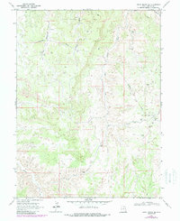
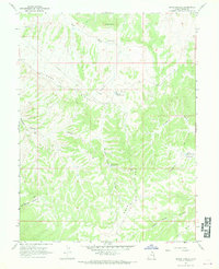
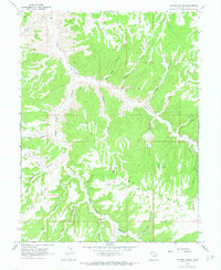
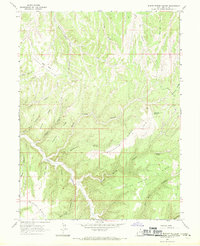
Oil Springs Oil and Gas Field and the Rock House Gas Field dominate this 1960s landscape in Uintah County, showing the infrastructure of energy extraction in the Uinta Basin. The map details a network of industrial and ranching activity, including a Landing Strip, Landing Field, and several pipelines crossing the terrain. For genealogists and local historians, these surveys document specific isolated structures like Seely Cabin and livestock management points such as Olsen Corral and Cedar Corral. Drainage systems including Atchee Wash, Saddletree Draw, and Bitter Creek carve through the region, while numerous gas wells and drill holes mark the expansion of the natural gas industry during this era. The presence of jeep trails and unimproved roads highlights the remote nature of the operations near the West Fork Asphalt Wash.
Find a feature on this map
23 named features on this map. Tap any name to fly to it.
Don’t see what you’re looking for? This feature index may not catch every label — zoom into the map to look around manually.
Map Details
Editions of this 1968 Archy Bench SE Map
2 editions found
Other maps of this area

1885 · East Tavaputs
USGS Topo · 1:250,000

1956 · Grand Junction
USGS Topo · 1:250,000

1959 · Grand Junction
USGS Topo · 1:250,000

1960 · Grand Junction
USGS Topo · 1:250,000

1962 · Grand Junction
USGS Topo · 1:250,000

1964 · Grand Junction
USGS Topo · 1:250,000

1965 · Grand Junction
USGS Topo · 1:250,000
1966 · Bates Knolls
USGS Topo · 1:24,000
1966 · Copper Canyon
USGS Topo · 1:24,000
1966 · Burnt Timber Canyon
USGS Topo · 1:24,000