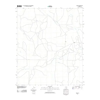
2010 Map of Arden
USGS Topo · Published 2010About this map
Arden serves as the focal point of this Irion County landscape, situated where the high plains meet the intricate drainage systems of the Edwards Plateau. The settlement is defined by its proximity to the Middle Concho River, which winds across the southern reaches of the map. This area is characterized by a network of intermittent waterways, including the convergence of West Rocky Creek and Dry Rocky Creek to the north, alongside the winding path of Dry Creek. The presence of the Arden Cemetery near the junction of FM 853 and Co Rd 428 provides a vital point of reference for genealogists tracking early ranching families in this part of West Texas. The sparse road network, featuring Mertz Rd and Co Rd 411, reflects a rural economy shaped by the rugged hydrology of the Concho basin.
Find a feature on this map
10 named features on this map. Tap any name to fly to it.
Don’t see what you’re looking for? This feature index may not catch every label — zoom into the map to look around manually.
Map Details
Editions of this 2010 Arden Map
This is the sole edition of this map. No revisions or reprints were ever made.
Other maps of this area

1895 · Sherwood
USGS Topo · 1:125,000

1928 · Tankersly
USGS Topo · 1:62,500

1954 · San Angelo
USGS Topo · 1:250,000

1957 · Carlsbad
USGS Topo · 1:62,500

1957 · Knickerbocker
USGS Topo · 1:62,500

1958 · San Angelo
USGS Topo · 1:250,000

1965 · San Angelo
USGS Topo · 1:250,000

1972 · Arden
USGS Topo · 1:24,000

1972 · Wallace Draw
USGS Topo · 1:24,000
1972 · Mertzon SW
USGS Topo · 1:24,000