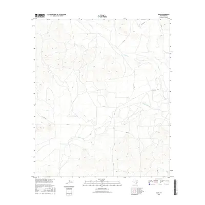
2016 Map of Arden
USGS Topo · Published 2016About this map
Arden serves as the focal point of this West Texas landscape, situated near the confluence of local watercourses. The drainage of the Middle Concho River and its seasonal tributaries, including Dry Cr and W Rocky Cr, dictate the movement of roads through the area. Ranching history is visible in the network of rural routes such as Funk Ranch Rd and Mertz Rd, which navigate the terrain of the Edwards Plateau. For those tracing family ties to the region, the Arden Cem remains a significant landmark near the central settlement area. The map illustrates a transition from the structured grid of regional county roads to the winding paths required by the river's path, providing a detailed look at Irion County land use in the early twenty-first century.
Find a feature on this map
15 named features on this map. Tap any name to fly to it.
Don’t see what you’re looking for? This feature index may not catch every label — zoom into the map to look around manually.
Map Details
Editions of this 2016 Arden Map
This is the sole edition of this map. No revisions or reprints were ever made.
Other maps of this area

1895 · Sherwood
USGS Topo · 1:125,000

1928 · Tankersly
USGS Topo · 1:62,500

1954 · San Angelo
USGS Topo · 1:250,000

1957 · Carlsbad
USGS Topo · 1:62,500

1957 · Knickerbocker
USGS Topo · 1:62,500

1958 · San Angelo
USGS Topo · 1:250,000

1965 · San Angelo
USGS Topo · 1:250,000

1972 · Arden
USGS Topo · 1:24,000

1972 · Wallace Draw
USGS Topo · 1:24,000
1972 · Mertzon SW
USGS Topo · 1:24,000