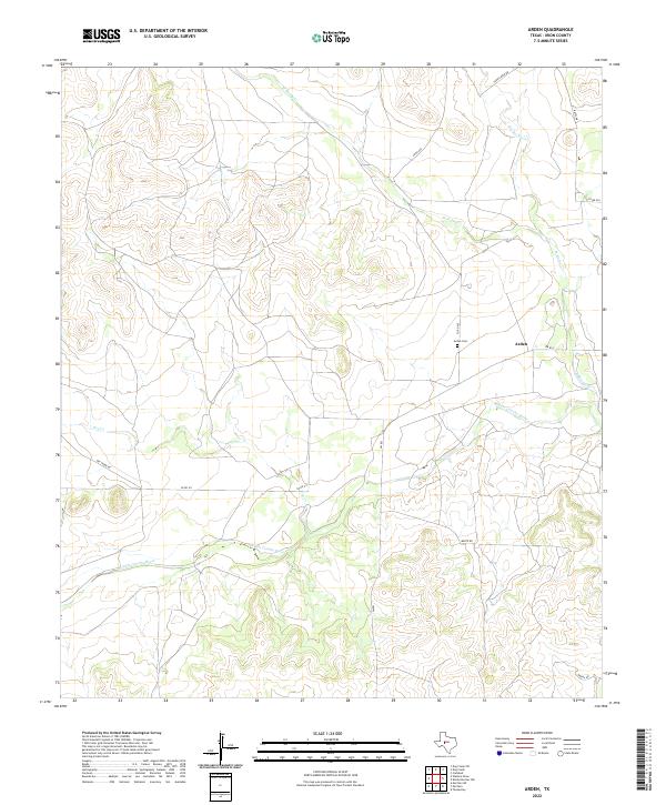
2022 Map of Arden
USGS Topo · Published 2022About this map
The Middle Concho River winds through this Irion County landscape, anchoring a ranching region defined by intermittent drainages and elevated plateaus. The small settlement of Arden is the primary point of interest, situated near the Arden Cem and the junction of FM 853 and Co RD 420. The terrain is deeply incised by several seasonal watercourses, including W Rocky Cr, Dry Rocky Cr, and Dry Cr, which carve through the high ground in the northern and western sections of the map.
Find a feature on this map
15 named features on this map. Tap any name to fly to it.
Don’t see what you’re looking for? This feature index may not catch every label — zoom into the map to look around manually.
Map Details
Editions of this 2022 Arden Map
This is the sole edition of this map. No revisions or reprints were ever made.
Other maps of this area

1895 · Sherwood
USGS Topo · 1:125,000

1928 · Tankersly
USGS Topo · 1:62,500

1954 · San Angelo
USGS Topo · 1:250,000

1957 · Carlsbad
USGS Topo · 1:62,500

1957 · Knickerbocker
USGS Topo · 1:62,500

1958 · San Angelo
USGS Topo · 1:250,000

1965 · San Angelo
USGS Topo · 1:250,000

1972 · Arden
USGS Topo · 1:24,000

1972 · Wallace Draw
USGS Topo · 1:24,000
1972 · Mertzon SW
USGS Topo · 1:24,000