Loading...
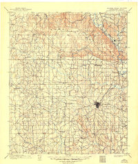
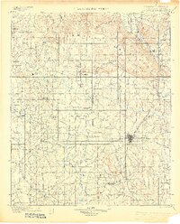
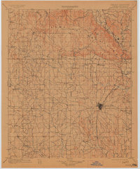
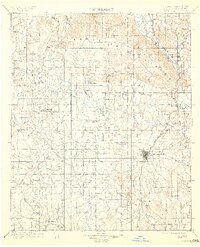
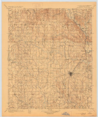
Loading map...1901 Map of Ardmore
USGS Topo · Published 1949About this map
Ardmore serves as the focal point of this Chickasaw Nation territory, where the Gulf Colorado and Santa Fe Railway branches through the landscape. Surveyed just before the turn of the century, the map documents a transition from open prairie to established railroad towns. To the north, the Arbuckle Mountains provide a dramatic geologic contrast, with the Washita River cutting through the eastern uplands near Dougherty.
Find a feature on this map
83 named features on this map. Tap any name to fly to it.
Don’t see what you’re looking for? This feature index may not catch every label — zoom into the map to look around manually.
Map Details
Date Portrayed1901
Date Published1949
PublisherU.S. Geological Survey
Map TypeTopographic
Scale1:125,000
Physical Dimensions17 x 20.3 inches
Editions of this 1901 Ardmore Map
6 editions found

Historical Maps of Ardmore Through Time
5 maps found


Featured Locations
Source Details
SourceU.S. Geological Survey
CopyrightPublic Domain