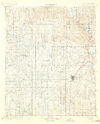
1901 Map of Ardmore
USGS Topo · Published 1913About this map
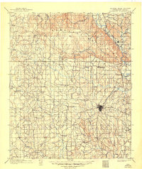
The Arbuckle Mountains dominate the northern terrain of this Chickasaw Nation territory, where the Washita River cuts a deep path past the town of Dougherty. Settlement is concentrated around the regional hub of Ardmore, which sits at the junction of developing road networks and the Gulf Colorado and Santa Fe R. R. The map documents a landscape in transition, marked by the Indian Meridian and numerous small communities like Healdton, Berwyn, and Lonegrove. Industrial activity is evident in several locations, specifically where an Asphalt Mine is noted near the mountains and again further south. This survey, conducted just before the turn of the century, provides a look at the early township structure and the distribution of family-named settlements like Keller, Hewitt, and Wilson before later twentieth-century development changed the local geography.
Find a feature on this map
85 named features on this map. Tap any name to fly to it.
Don’t see what you’re looking for? This feature index may not catch every label — zoom into the map to look around manually.
Map Details
Editions of this 1901 Ardmore Map
6 editions found
Other maps of this area

1898 · Pauls Valley
USGS Topo · 1:125,000

1901 · Stonewall
USGS Topo · 1:125,000

1901 · Addington
USGS Topo · 1:125,000

1901 · Tishomingo
USGS Topo · 1:125,000

1901 · Ardmore
USGS Topo · 1:125,000

1901 · Denison
USGS Topo · 1:125,000

1902 · Gainesville
USGS Topo · 1:125,000

1902 · Pauls Valley
USGS Topo · 1:125,000

1902 · Rush Springs
USGS Topo · 1:125,000

1905 · Montague
USGS Topo · 1:125,000