
1964 Map of Ardmore East
USGS Topo · Published 1965About this map
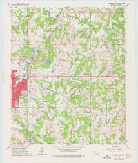
The eastern edges of Ardmore anchor this mid-century survey, revealing the city's residential expansion alongside established industrial sites like numerous Gravel Pits. Transportation is defined by the Gulf Colorado and Santa Fe Railway and the St Louis - San Francisco line, which intersect the landscape north of the developing Lake Murray State Park. To the east, the rural character remains intact with family-named landmarks like Caldwell Hill and small community hubs including Springdale Church and Provence Church. Local history and genealogy are well-represented by several small burial grounds, such as Mt Zion Cemetery and Pruitt Cemetery. The topography transitions from the urban street grid of Ardmore to the wooded creeks of Anadarko Creek and Fourche Maline, illustrating the area's development just before the modern era of interstate expansion.
Find a feature on this map
38 named features on this map. Tap any name to fly to it.
Don’t see what you’re looking for? This feature index may not catch every label — zoom into the map to look around manually.
Map Details
Editions of this 1964 Ardmore East Map
4 editions found
Other maps of this area

1901 · Tishomingo
USGS Topo · 1:125,000

1901 · Ardmore
USGS Topo · 1:125,000

1918 · Ardmore
USGS Topo · 1:125,000

1957 · Ardmore
USGS Topo · 1:250,000

1963 · Ardmore
USGS Topo · 1:250,000

1963 · Mannsville
USGS Topo · 1:24,000

1963 · Mc Millan
USGS Topo · 1:24,000

1963 · Nebo
USGS Topo · 1:24,000

1964 · Lake Murray
USGS Topo · 1:24,000

1964 · Ardmore West
USGS Topo · 1:24,000