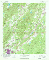
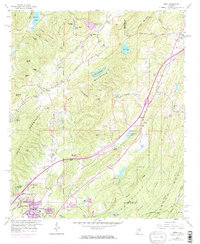
1959 Map of Argo
USGS Topo · Published 1971About this map
The Cahaba River winds through the heart of this landscape, carving through Red Mountain and defining the development of communities like Trussville and Argo. The 1970 revisions, indicated in purple, reveal the significant suburban expansion of Trussville and Cahaba Crest as the Birmingham metro area pushed eastward. This growth is juxtaposed against the established industrial footprint of the region, visible in the numerous Strip Mines, Chert Pits, and a large Quarry situated between Chalkville and the river banks.
Find a feature on this map
68 named features on this map. Tap any name to fly to it.
Don’t see what you’re looking for? This feature index may not catch every label — zoom into the map to look around manually.
Map Details
Editions of this 1959 Argo Map
5 editions found
Other maps of this area

1889 · Springville
USGS Topo · 1:125,000

1889 · Birmingham
USGS Topo · 1:125,000

1892 · Birmingham
USGS Topo · 1:125,000

1892 · Springville
USGS Topo · 1:125,000

1895 · Birmingham
USGS Topo · 1:125,000

1905 · Leeds
USGS Topo · 1:62,500

1907 · Birmingham
USGS Topo · 1:125,000

1907 · Leeds
USGS Topo · 1:62,500

1953 · Birmingham
USGS Topo · 1:250,000

1956 · Birmingham
USGS Topo · 1:250,000