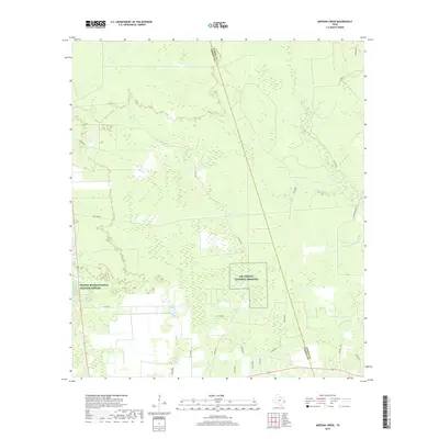
2019 Map of Arizona Creek
USGS Topo · Published 2019About this map
Trinity River National Wildlife Refuge and the Big Thicket National Preserve dominate this section of the coastal plain where Liberty and Hardin counties meet. The landscape is defined by a dense network of slow-moving waterways, including the winding Arizona Creek and Pine Island Bayou, which create a complex environment of sloughs and bottomlands. Industrial and rural footprints are visible through markings for Omnex Oil and a grid of timber and county roads.
Find a feature on this map
32 named features on this map. Tap any name to fly to it.
Don’t see what you’re looking for? This feature index may not catch every label — zoom into the map to look around manually.
Map Details
Editions of this 2019 Arizona Creek Map
This is the sole edition of this map. No revisions or reprints were ever made.
Other maps of this area

1943 · Liberty
USGS Topo · 1:125,000

1954 · Beaumont
USGS Topo · 1:250,000

1955 · Daisetta
USGS Topo · 1:62,500

1955 · Saratoga
USGS Topo · 1:62,500

1955 · Rayburn
USGS Topo · 1:62,500

1955 · Liberty
USGS Topo · 1:62,500

1957 · Beaumont
USGS Topo · 1:250,000

1984 · Beaumont
USGS Topo · 1:250,000
1984 · Saratoga
USGS Topo · 1:24,000
1984 · Arizona Creek
USGS Topo · 1:24,000