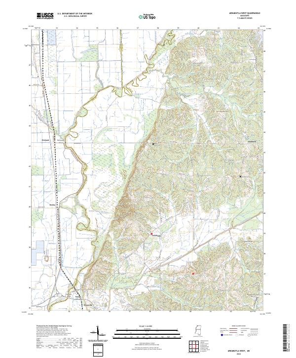
2024 Map of Arkabutla West
USGS Topo · Published 2024About this map
The Coldwater River meanders through the heart of this landscape, its path reinforced by the Coldwater River Levee as it flows past a network of historical crossing points and lowland bayous. This area of Tate County is characterized by a transition from the alluvial bottomlands of the Big Bayou and Lake Cormorant Bayou systems to the rising elevations of the Bluff to the east. The map documents long-established rural settlements such as Cottonville, Prichard, and Savage, alongside historical infrastructure like Thompsons Ferry and Hudsons Ferry. Local history is anchored by sites like Surretts Cem and Bluff Road Cem, which sit among a grid of family-named roads including Allison Rd, Moore Rd, and Davis Rd. Modern use of the terrain is represented by the Strayhorn Hay Field Airport in the southeastern corner near Arkabutla Creek.
Find a feature on this map
73 named features on this map. Tap any name to fly to it.
Don’t see what you’re looking for? This feature index may not catch every label — zoom into the map to look around manually.
Map Details
Editions of this 2024 Arkabutla West Map
This is the sole edition of this map. No revisions or reprints were ever made.
Other maps of this area

1908 · Hollywood
USGS Topo · 1:24,000

1908 · Walnut Lake
USGS Topo · 1:24,000

1910 · Walnut Lake
USGS Topo · 1:31,680

1913 · Hollywood
USGS Topo · 1:31,680

1931 · Horseshoe Lake
USGS Topo · 1:62,500

1932 · Horn Lake
USGS Topo · 1:48,000

1932 · Crenshaw
USGS Topo · 1:62,500

1935 · Crenshaw
USGS Topo · 1:62,500

1935 · Horn Lake
USGS Topo · 1:62,500

1939 · Clayton
USGS Topo · 1:62,500