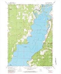
1969 Map of Arkdale NW
USGS Topo · Published 1984About this map
Petenwell Lake dominates this landscape along the Wisconsin River, where the borders of Wood, Juneau, and Adams Counties converge. In the late 1960s, the eastern shoreline near New Rome shows a growing network of residential streets such as Apache Ave and Aspen Avenue, serving as a recreational hub centered around Barnum Bay and Twin Lakes. This development contrasts sharply with the western shore, which remains largely dominated by the National Guard Bombing and Gunnery Range and its Cranberry Rock Lookout Tower. Between these military and residential zones, public access points like Petenwell Wilderness Park and Monroe Park provide a glimpse into the regional shift toward outdoor leisure. The map also captures local landmarks like the New Rome Ch and several industrial features, including a Quarry and various sandpits, reflecting the local geology and economy of the era.
Find a feature on this map
38 named features on this map. Tap any name to fly to it.
Don’t see what you’re looking for? This feature index may not catch every label — zoom into the map to look around manually.
Map Details
Editions of this 1969 Arkdale NW Map
3 editions found
Other maps of this area

1953 · Eau Claire
USGS Topo · 1:250,000

1955 · Green Bay
USGS Topo · 1:250,000

1957 · Wisconsin Rapids
USGS Topo · 1:48,000

1957 · Pittsville
USGS Topo · 1:48,000

1958 · Eau Claire
USGS Topo · 1:250,000

1958 · Arkdale
USGS Topo · 1:48,000

1958 · Necedah
USGS Topo · 1:48,000

1964 · Eau Claire
USGS Topo · 1:250,000

1967 · Roche A Cri
USGS Topo · 1:24,000

1967 · Arkdale NE
USGS Topo · 1:24,000