1965 Map of Arlington
USGS Topo · Published 1974About this map
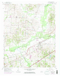
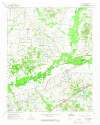
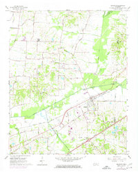
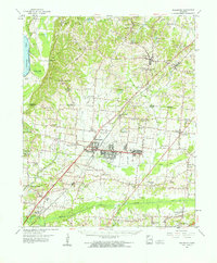
Arlington and its surrounding agricultural landscape are defined by a complex network of water management and transportation corridors in the mid-1960s. The Loosahatchie River and several artificial channels like the Beaver Creek Canal and Cypress Creek Canal dominate the lowlands, reflecting a landscape heavily modified for drainage and farming. The town itself is a hub for the Louisville and Nashville railroad, which parallels the river and connects the community to broader trade networks.
Find a feature on this map
45 named features on this map. Tap any name to fly to it.
Don’t see what you’re looking for? This feature index may not catch every label — zoom into the map to look around manually.
Map Details
Editions of this 1965 Arlington Map
3 editions found
Other maps of this area
1942 · Millington
USGS Topo · 1:62,500

1943 · Collierville
USGS Topo · 1:62,500

1953 · Collierville
USGS Topo · 1:50,000

1954 · Mason
USGS Topo · 1:62,500

1956 · Blytheville
USGS Topo · 1:250,000

1959 · Blytheville
USGS Topo · 1:250,000
1960 · Bartlett
USGS Topo · 1:62,500
1960 · Millington
USGS Topo · 1:62,500
1961 · Bartlett
USGS Topo · 1:62,500
1965 · Oakland
USGS Topo · 1:24,000