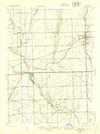
1945 Map of Armada
USGS Topo · Published 1945About this map
The village of Armada serves as the focal point for this mid-1940s landscape, where the Grand Trunk Western railroad provides a critical east-west connection through Macomb County. The surrounding townships of Bruce, Armada, Washington, and Ray are defined by an intensive network of family-named schools and small burial grounds, reflecting a deeply rooted agricultural community. Notable schoolhouses such as Donaldson Sch, Stephens Sch, and Wolcott Mills Sch are distributed across the grid-patterned roads, marking the locations of rural neighborhood centers.
Find a feature on this map
46 named features on this map. Tap any name to fly to it.
Don’t see what you’re looking for? This feature index may not catch every label — zoom into the map to look around manually.
Map Details
Editions of this 1945 Armada Map
2 editions found

Other maps of this area

1908 · Rochester
USGS Topo · 1:62,500

1912 · Mt Clemens
USGS Topo · 1:62,500

1914 · Armada
USGS Topo · 1:62,500

1928 · Armada
USGS Topo · 1:62,500

1929 · Mt Clemens
USGS Topo · 1:62,500

1936 · New Haven
USGS Topo · 1:31,680

1936 · Washington
USGS Topo · 1:31,680

1936 · Waldenburg
USGS Topo · 1:31,680

1943 · Romeo
USGS Topo · 1:24,000

1944 · Memphis
USGS Topo · 1:24,000