
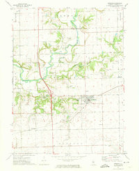
1980 Map of Armington
USGS Topo · Published 1980About this map
The village of Armington sits as the central hub of this Central Illinois landscape, where the borders of Tazewell, Logan, and McLean counties converge. The area is defined by the branching waters of Sugar Creek, including its West Fork and Middle Fork. This 1980 edition provides an exceptional record for genealogists, documenting an unusual density of family-named burial grounds such as Hittle Grove Cem, Hieronymus Cem, and Thompson Cem scattered across the townships of Hittle and Eminence. Transportation history is marked by the route of the Illinois Terminal railroad, while local social landmarks like Camp Griesheim, Roadside Park, and the Feist Landing Strip reflect the mid-century development of this agricultural region.
Find a feature on this map
37 named features on this map. Tap any name to fly to it.
Don’t see what you’re looking for? This feature index may not catch every label — zoom into the map to look around manually.
Map Details
Editions of this 1980 Armington Map
This is the sole edition of this map. No revisions or reprints were ever made.
Other maps of this area

1911 · Lincoln
USGS Topo · 1:62,500

1913 · Lincoln
USGS Topo · 1:62,500

1949 · Mc Lean
USGS Topo · 1:62,500

1951 · McLean
USGS Topo · 1:62,500

1951 · Minier
USGS Topo · 1:62,500

1957 · Kenney
USGS Topo · 1:62,500

1958 · Peoria
USGS Topo · 1:250,000

1961 · Peoria
USGS Topo · 1:250,000

1963 · Peoria
USGS Topo · 1:250,000
1971 · Hopedale
USGS Topo · 1:24,000