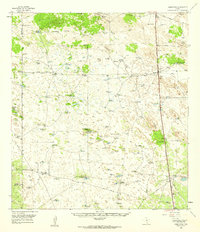
1956 Map of Armstrong
USGS Topo · Published 1959About this map
The Missouri Pacific railroad corridor anchors this survey of Kenedy County, serving as the industrial spine for isolated outposts like Armstrong and Norias. This is a landscape defined by large-scale ranching and mineral extraction, where the Armstrong Ranch Headquarters and smaller sites like Pita Camp and Ball Ranch managed the arid terrain. The map captures a transition in land use as traditional ranching was increasingly accompanied by resource exploration, evidenced by numerous Oil Wells and Caliche Pits scattered across the brushland.
Find a feature on this map
29 named features on this map. Tap any name to fly to it.
Don’t see what you’re looking for? This feature index may not catch every label — zoom into the map to look around manually.
Map Details
Editions of this 1956 Armstrong Map
This is the sole edition of this map. No revisions or reprints were ever made.
Other maps of this area

1921 · Falfurrias
USGS Topo · 1:125,000

1921 · Tarida Ranch
USGS Topo · 1:62,500

1922 · La Sal Vieja
USGS Topo · 1:62,500

1923 · Armstrong
USGS Topo · 1:62,500

1923 · Saltillo Ranch
USGS Topo · 1:62,500

1928 · Sarita
USGS Topo · 1:125,000

1939 · Linn
USGS Topo · 1:62,500

1949 · Mc Allen
USGS Topo · 1:250,000

1950 · Corpus Christi
USGS Topo · 1:250,000

1953 · Brownsville
USGS Topo · 1:250,000