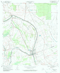
1970 Map of Arnaudville
USGS Topo · Published 1986About this map
Arnaudville and the winding course of Bayou Teche anchor this 1970 study of the Acadiana landscape. The survey documents the intricate water systems of the region, where Bayou Fusilier and Bayou Bourbeux intersect with human-engineered infrastructure like the Missouri Pacific railroad. The map reveals a transition in land use, showing traditional settlements like Leonville and Pecaniere alongside specialized agriculture, noted by several instances of a Crawfish Farm.
Find a feature on this map
28 named features on this map. Tap any name to fly to it.
Don’t see what you’re looking for? This feature index may not catch every label — zoom into the map to look around manually.
Map Details
Editions of this 1970 Arnaudville Map
2 editions found
Other maps of this area

1939 · Opelousas
USGS Topo · 1:62,500

1940 · Arnaudville
USGS Topo · 1:62,500

1952 · Lake Charles
USGS Topo · 1:250,000

1954 · Lake Charles
USGS Topo · 1:250,000

1954 · Baton Rouge
USGS Topo · 1:250,000

1956 · Opelousas
USGS Topo · 1:62,500

1956 · Baton Rouge
USGS Topo · 1:250,000

1957 · Opelousas
USGS Topo · 1:62,500

1957 · Carencro
USGS Topo · 1:62,500

1959 · Palmetto
USGS Topo · 1:62,500