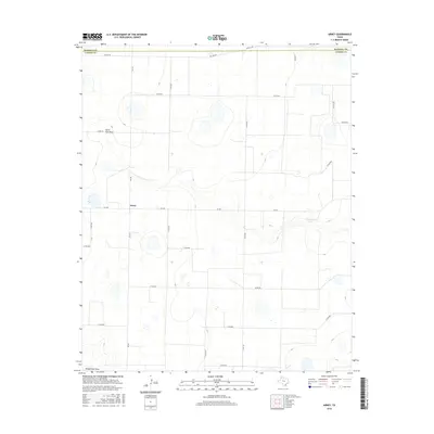
2016 Map of Arney
USGS Topo · Published 2016About this map
The high plains settlement of Arney sits at the intersection of Fm 168 and Fm 1075, serving as a central point for the surrounding agricultural landscape of Castro County. This 2016 survey reveals the characteristic drainage patterns of the Llano Estacado, where ephemeral watercourses like North Tule Draw and Middle Tule Draw carve subtle depressions across the plateau. The presence of Cone Johnson Lake indicates a significant water feature in an otherwise arid region, likely reflecting local water management or irrigation needs. The map captures the highly organized section-line road network, including the Randall Co and Castro Co boundary line, which defines the geometric layout of this Panhandle farming community. These features illustrate the intersection of natural hydrology and the rigid grid system imposed by Texas land surveying.
Find a feature on this map
24 named features on this map. Tap any name to fly to it.
Don’t see what you’re looking for? This feature index may not catch every label — zoom into the map to look around manually.
Map Details
Editions of this 2016 Arney Map
This is the sole edition of this map. No revisions or reprints were ever made.
Other maps of this area

1954 · Plainview
USGS Topo · 1:250,000

1954 · Clovis
USGS Topo · 1:250,000

1958 · Clovis
USGS Topo · 1:250,000

1958 · Plainview
USGS Topo · 1:250,000

1960 · Canyon
USGS Topo · 1:62,500

1961 · Buffalo Lake
USGS Topo · 1:62,500

1965 · Lakeview
USGS Topo · 1:24,000

1965 · Nazareth SW
USGS Topo · 1:24,000

1965 · Nazareth
USGS Topo · 1:24,000

1966 · Tulia NW
USGS Topo · 1:24,000