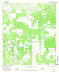
1967 Map of Art
USGS Topo · Published 1982About this map
The Llano River carves a winding path through this central Texas landscape, creating a distinct topographical divide between the settlements of Art and Hedwigs Hill. The map reveals a community deeply rooted in the land, with numerous family-named landmarks and cemeteries scattered across the drainage basins of Willow Creek and Mulberry Creek. Genealogists will find particular value in the documentation of localized burial grounds such as West Art Cem, East Art Cem, and the Kothmann Cem. A Gaging Sta and Roadside Park along the southern riverbank indicate the importance of water monitoring and early highway travel in this area. The intersection of Fly Gap Road with local thoroughfares further illustrates the historical transport network connecting these rural Mason County outposts.
Find a feature on this map
25 named features on this map. Tap any name to fly to it.
Don’t see what you’re looking for? This feature index may not catch every label — zoom into the map to look around manually.
Map Details
Editions of this 1967 Art Map
2 editions found
Other maps of this area

1887 · Llano
USGS Topo · 1:125,000

1887 · Mason
USGS Topo · 1:125,000

1894 · Mason
USGS Topo · 1:125,000

1894 · Llano
USGS Topo · 1:125,000

1904 · Llano
USGS Topo · 1:125,000

1909 · Llano
USGS Topo · 1:125,000

1918 · Llano
USGS Topo · 1:125,000

1954 · Llano
USGS Topo · 1:250,000

1955 · Llano
USGS Topo · 1:250,000
1955 · Smoothingiron Mountain
USGS Topo · 1:24,000