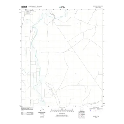
2010 Map of Artesia NE
USGS Topo · Published 2010About this map
Lake Arthur serves as the primary settlement at the northwestern edge of this Chaves County landscape, positioned along the meandering course of the Pecos River. The 2010 geography reveals a transition from small-town infrastructure, including the Lake Arthur Post Office, to an expansive network of rural county roads and ranch access routes. Waterways such as Walnut Creek, Cottonwood Creek, and the southern Dog Canyon Draw define the drainage patterns of this semi-arid basin. The road system, featuring named thoroughfares like Buffalo Valley Rd and Rat Camp Rd, reflects a landscape organized around cattle ranching and agricultural access. Local family history and land use are etched into the map through features like Karr Ranch Rd and Lawrence Ranch Rd, which mark the paths connecting isolated ranch sites to the regional trade center.
Find a feature on this map
17 named features on this map. Tap any name to fly to it.
Don’t see what you’re looking for? This feature index may not catch every label — zoom into the map to look around manually.
Map Details
Editions of this 2010 Artesia NE Map
This is the sole edition of this map. No revisions or reprints were ever made.
Other maps of this area

1951 · Ninemile Well
USGS Topo · 1:24,000

1951 · Diamond Mound
USGS Topo · 1:24,000

1951 · Hagerman
USGS Topo · 1:24,000

1952 · Hagerman SW
USGS Topo · 1:24,000

1953 · Espuela
USGS Topo · 1:24,000

1954 · Carlsbad
USGS Topo · 1:250,000

1955 · Artesia
USGS Topo · 1:24,000

1955 · Artesia NE
USGS Topo · 1:24,000

1955 · Spring Lake
USGS Topo · 1:24,000

1955 · Roswell
USGS Topo · 1:250,000