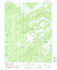
1985 Map of Asay Bench
USGS Topo · Published 1985About this map
Dixie National Forest dominates this mid-1980s terrain, where the high-altitude landscape of the Markagunt Plateau drops toward the volcanic and sedimentary formations of Asay Bench. The geography is defined by a series of named flats and knolls, such as Houston Flat and Bowers Knoll, illustrating the complex topography of the Southern Utah uplands. Water sources are critical identifiers here, with numerous springs like Wilson Spring, Asay Spring, and Cold Spring feeding into drainages like Mammoth Creek and Swains Creek.
Find a feature on this map
30 named features on this map. Tap any name to fly to it.
Don’t see what you’re looking for? This feature index may not catch every label — zoom into the map to look around manually.
Map Details
Editions of this 1985 Asay Bench Map
This is the sole edition of this map. No revisions or reprints were ever made.
Other maps of this area

1886 · Kanab
USGS Topo · 1:250,000

1953 · Cedar City
USGS Topo · 1:250,000

1958 · Cedar City
USGS Topo · 1:250,000

1958 · Orderville
USGS Topo · 1:62,500

1958 · Panguitch Lake
USGS Topo · 1:62,500

1962 · Cedar City
USGS Topo · 1:250,000

1966 · Alton
USGS Topo · 1:24,000

1966 · Hatch
USGS Topo · 1:24,000

1966 · George Mtn
USGS Topo · 1:24,000

1980 · Panguitch
USGS Topo · 1:100,000