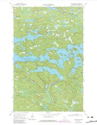
1968 Map of Ash River NE
USGS Topo · Published 1983About this map
Voyageurs National Park and the Kabetogama State Forest meet in this landscape of complex water networks and island chains. The map documents the intricate shoreline and bathymetry of Kabetogama Lake and Namakan Lake, where several portage routes and campsites indicate the area's importance for water-based navigation and recreation. At the intersection of Sullivan Bay and the Ash River, the Ash River Campground and a Ranger Station serve as primary points of human activity. The presence of Cemetery Island and the Ash River Lookout Tower reflect the layer of early development within this protected wilderness. Deep-water channels like the Blind Indian Narrows and secluded reaches such as Lost Bay reveal a geography defined by the glacial scouring of the Canadian Shield.
Find a feature on this map
45 named features on this map. Tap any name to fly to it.
Don’t see what you’re looking for? This feature index may not catch every label — zoom into the map to look around manually.
Map Details
Editions of this 1968 Ash River NE Map
2 editions found

Other maps of this area

1954 · International Falls
USGS Topo · 1:250,000

1957 · International Falls
USGS Topo · 1:250,000

1958 · International Falls
USGS Topo · 1:250,000

1967 · Namakan Island
USGS Topo · 1:24,000

1967 · Marion Lake
USGS Topo · 1:24,000

1967 · Kempton Bay
USGS Topo · 1:24,000
1967 · Kettle Falls
USGS Topo · 1:24,000

1968 · Soldier Point
USGS Topo · 1:24,000

1968 · Daley Bay
USGS Topo · 1:24,000

1968 · Ash River SE
USGS Topo · 1:24,000