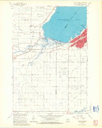
1964 Map of Ashland West
USGS Topo · Published 1965About this map
Chequamegon Bay dominates the northern reaches of this mid-1960s survey, where the industrial and educational hub of Ashland meets the shoreline. The city's layout is defined by the heavy presence of the Chicago and North Western and Northern Pacific railroads, which converge at Ashland Junction. Beyond the urban core, the landscape transitions into the agricultural and scientific research grounds of the University of Wisconsin Experiment Station and the campus of Northland College. To the west, the community of Barksdale sits near the mouth of Whittlesey Creek, while the southern reaches are marked by the meandering White River and Gingles. The map captures a period of civic infrastructure, documenting the John F Kennedy Memorial Airport and several major local institutions, including the County Home and St Agnes Cemetery.
Find a feature on this map
42 named features on this map. Tap any name to fly to it.
Don’t see what you’re looking for? This feature index may not catch every label — zoom into the map to look around manually.
Map Details
Editions of this 1964 Ashland West Map
4 editions found
Other maps of this area

1942 · Ashland
USGS Topo · 1:48,000

1942 · Marengo
USGS Topo · 1:48,000

1944 · Moquah
USGS Topo · 1:48,000

1944 · Grandview
USGS Topo · 1:48,000

1945 · Marengo
USGS Topo · 1:48,000

1947 · Moquah
USGS Topo · 1:48,000

1947 · Ashland
USGS Topo · 1:48,000

1947 · Grandview
USGS Topo · 1:48,000

1953 · Ashland
USGS Topo · 1:250,000

1958 · Ashland
USGS Topo · 1:250,000