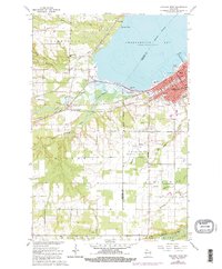
1964 Map of Ashland West
USGS Topo · Published 1976About this map
Ashland serves as the focal point of this coastal survey, where the city's grid meets the southwestern shore of Chequamegon Bay. The landscape is a mix of educational institutions and early industrial infrastructure, featuring Northland College, the University of Wisconsin Experiment Station, and the DePadua High Sch. A dense network of transportation lines, including the Chicago and North Western and Northern Pacific railroads, converges at Ashland Junction, illustrating the area's importance as a regional transit hub. Outside the urban center, the land transitions to the agricultural and wooded townships of Barksdale and Eileen. Along the waterfront, Wyman Point and Maslowski Park provide public access to the bay, while the southern reaches are defined by the winding paths of Fish Creek and the White River. Notable local landmarks such as the John F Kennedy Memorial Airport and Mt Hope Cemetery provide valuable geographic markers for genealogists and local historians.
Find a feature on this map
46 named features on this map. Tap any name to fly to it.
Don’t see what you’re looking for? This feature index may not catch every label — zoom into the map to look around manually.
Map Details
Editions of this 1964 Ashland West Map
4 editions found
Other maps of this area

1942 · Ashland
USGS Topo · 1:48,000

1942 · Marengo
USGS Topo · 1:48,000

1944 · Moquah
USGS Topo · 1:48,000

1944 · Grandview
USGS Topo · 1:48,000

1945 · Marengo
USGS Topo · 1:48,000

1947 · Moquah
USGS Topo · 1:48,000

1947 · Ashland
USGS Topo · 1:48,000

1947 · Grandview
USGS Topo · 1:48,000

1953 · Ashland
USGS Topo · 1:250,000

1958 · Ashland
USGS Topo · 1:250,000