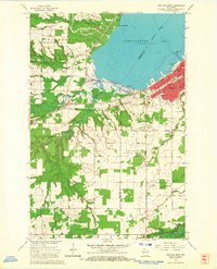
1964 Map of Ashland West
USGS Topo · Published 1965About this map
The western edges of Ashland and the surrounding rural townships of Barksdale, Eileen, and Gingles define this 1964 survey. The city's industrial and educational infrastructure is clearly visible along the southern shore of Chequamegon Bay, featuring Northland College, the Powerplant, and the DePadua High Sch. A heavy concentration of civic landmarks, such as the Courthouse and several cemeteries including Mt Hope Cemetery, establishes the mid-century footprint of the regional hub.
Find a feature on this map
43 named features on this map. Tap any name to fly to it.
Don’t see what you’re looking for? This feature index may not catch every label — zoom into the map to look around manually.
Map Details
Editions of this 1964 Ashland West Map
4 editions found
Other maps of this area

1942 · Ashland
USGS Topo · 1:48,000

1942 · Marengo
USGS Topo · 1:48,000

1944 · Moquah
USGS Topo · 1:48,000

1944 · Grandview
USGS Topo · 1:48,000

1945 · Marengo
USGS Topo · 1:48,000

1947 · Moquah
USGS Topo · 1:48,000

1947 · Ashland
USGS Topo · 1:48,000

1947 · Grandview
USGS Topo · 1:48,000

1953 · Ashland
USGS Topo · 1:250,000

1958 · Ashland
USGS Topo · 1:250,000