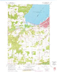
1964 Map of Ashland West
USGS Topo · Published 1976About this map
The southwest industrial and residential edge of Ashland meets the shoreline of Chequamegon Bay in this mid-1960s survey, updated with mid-1970s aerial revisions. The landscape is defined by the convergence of the Chicago and North Western and Northern Pacific railroads, which facilitated the region's shipping and transit economy. Educational and civic development is prominent, anchored by Northland College and the University of Wisconsin Experiment Station.
Find a feature on this map
44 named features on this map. Tap any name to fly to it.
Don’t see what you’re looking for? This feature index may not catch every label — zoom into the map to look around manually.
Map Details
Editions of this 1964 Ashland West Map
4 editions found
Other maps of this area

1942 · Ashland
USGS Topo · 1:48,000

1942 · Marengo
USGS Topo · 1:48,000

1944 · Moquah
USGS Topo · 1:48,000

1944 · Grandview
USGS Topo · 1:48,000

1945 · Marengo
USGS Topo · 1:48,000

1947 · Moquah
USGS Topo · 1:48,000

1947 · Ashland
USGS Topo · 1:48,000

1947 · Grandview
USGS Topo · 1:48,000

1953 · Ashland
USGS Topo · 1:250,000

1958 · Ashland
USGS Topo · 1:250,000