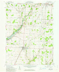
1961 Map of Ashley
USGS Topo · Published 1963About this map
Ashley and Cardington serve as the primary hubs in this central Ohio landscape, where the survey details a complex transition between distinct land systems. The Greenville Treaty Line creates a visible shift in property patterns, separating the Congress Lands to the north from the United States Military District to the south. This boundary bisects townships like Richland and Cardington, influencing the local road network and farm layouts. The topography is defined by the valley of Whetstone Creek, which feeds into the northern reaches of the Delaware Reservoir. Transportation is anchored by the New York Central line running through the heart of the village of Ashley, passing near the Richardson Airport and the local Waterworks. Numerous family and community burial grounds, including Ashley Union Cem and Gavitt Cem, are scattered across the rural townships of Westfield, Lincoln, and Oxford.
Find a feature on this map
61 named features on this map. Tap any name to fly to it.
Don’t see what you’re looking for? This feature index may not catch every label — zoom into the map to look around manually.
Map Details
Editions of this 1961 Ashley Map
2 editions found
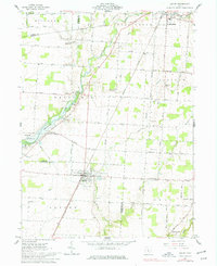
Other maps of this area

1903 · Marion
USGS Topo · 1:62,500

1905 · Marion
USGS Topo · 1:62,500

1913 · Mount Gilead
USGS Topo · 1:62,500

1915 · Marengo
USGS Topo · 1:62,500

1916 · Mount Gilead
USGS Topo · 1:62,500

1924 · Delaware
USGS Topo · 1:62,500

1925 · Delaware
USGS Topo · 1:62,500

1943 · Marengo
USGS Topo · 1:62,500

1943 · Mount Gilead
USGS Topo · 1:62,500

1944 · Delaware
USGS Topo · 1:62,500