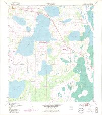
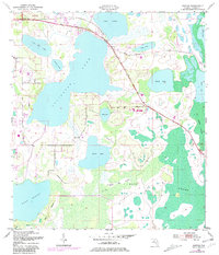
1953 Map of Ashton
USGS Topo · Published 1997About this map
Ashton and its surrounding wetlands define this Central Florida landscape, showing a region where massive water bodies and low-lying islands dictate the patterns of human settlement. The map reveals the early development of a Trailer Park nestled between Lake Lizzie and Alligator Lake, while the vast expanses of Big Bend Swamp and Jug Creek Swamp remain largely untouched.
Find a feature on this map
21 named features on this map. Tap any name to fly to it.
Don’t see what you’re looking for? This feature index may not catch every label — zoom into the map to look around manually.
Map Details
Editions of this 1953 Ashton Map
6 editions found
Other maps of this area

1953 · Cypress Lake
USGS Topo · 1:24,000

1953 · Holopaw SE
USGS Topo · 1:24,000

1953 · Narcoossee SE
USGS Topo · 1:24,000

1953 · St Cloud North
USGS Topo · 1:24,000

1953 · Narcoossee
USGS Topo · 1:24,000

1953 · St Cloud South
USGS Topo · 1:24,000

1953 · Holopaw SW
USGS Topo · 1:24,000

1953 · Ashton
USGS Topo · 1:24,000

1953 · Holopaw
USGS Topo · 1:24,000

1955 · Orlando
USGS Topo · 1:250,000