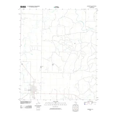
2010 Map of Aspermont
USGS Topo · Published 2010About this map
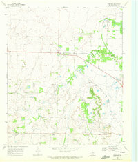
The town of Aspermont serves as the focal point of this North Texas survey, situated within a landscape defined by the drainage systems of the Salt Fork Brazos River and several tributary creeks. The region's economic and infrastructure profile is anchored by the Boyd Oil Field to the northeast and aviation facilities including the Stonewall County Airport and Douglas Flying Service Airport. The map documents a network of rural routes such as FM 1263 and FM 1835 that connect the central settlement to the surrounding ranching and petroleum lands. Watercourses with distinctive local names, including Stinking Creek, Turkey Roost Creek, and Tonk Creek, carve through the terrain, illustrating the natural geography that has shaped the development of this portion of Stonewall County.
Find a feature on this map
31 named features on this map. Tap any name to fly to it.
Don’t see what you’re looking for? This feature index may not catch every label — zoom into the map to look around manually.
Map Details
Editions of this 2010 Aspermont Map
This is the sole edition of this map. No revisions or reprints were ever made.
Other maps of this area

1925 · Aspermont 4-a
USGS Topo · 1:48,000

1931 · Aspermont
USGS Topo · 1:62,500

1954 · Lubbock
USGS Topo · 1:250,000

1958 · Lovers Resort
USGS Topo · 1:24,000

1962 · Kiowa Peak
USGS Topo · 1:24,000
1962 · Frog Mountain
USGS Topo · 1:24,000

1967 · Kiowa Peak SW
USGS Topo · 1:24,000
1968 · Aspermont
USGS Topo · 1:24,000
1968 · Coon Hollow
USGS Topo · 1:24,000
1968 · Swenson
USGS Topo · 1:24,000