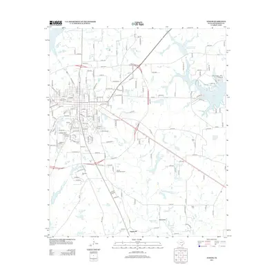
2013 Map of Athens
USGS Topo · Published 2013About this map
Athens Lake and the larger Athens Fish and Game Club Lake anchor the northeastern landscape of this East Texas community, reflecting the area's development around recreational and water management resources. The town center is defined by a dense street grid including State Loop 7, which encircles the core residential and commercial districts. This 2013 survey illustrates the modern footprint of Trinity Valley Community College and the Athens Municipal Airport, indicating the town's role as a regional educational and transportation hub. Outside the main settlement, the terrain is marked by smaller locales such as Walnut, Virginia Hill, and Pine Grove. For family historians, the inclusion of several burial sites like Richardson Cem, Barker Cem, and Davis Cem provides essential points of reference for local genealogy. The landscape is also heavily intersected by numerous creeks, including First Caney Cr and Coon Cr, which feed into various named reservoirs like Moonshine Lake Number 2 and Darby Farms Lake.
Find a feature on this map
189 named features on this map. Tap any name to fly to it.
Don’t see what you’re looking for? This feature index may not catch every label — zoom into the map to look around manually.
Map Details
Editions of this 2013 Athens Map
This is the sole edition of this map. No revisions or reprints were ever made.
Other maps of this area

1948 · Brownsboro
USGS Topo · 1:62,500

1948 · Martins Mill
USGS Topo · 1:62,500

1949 · Martins Mill
USGS Topo · 1:62,500

1949 · Brownsboro
USGS Topo · 1:62,500

1949 · Frankston
USGS Topo · 1:62,500

1949 · Athens
USGS Topo · 1:62,500

1950 · Athens
USGS Topo · 1:62,500

1950 · Frankston
USGS Topo · 1:62,500

1956 · Tyler
USGS Topo · 1:250,000

1984 · Tyler
USGS Topo · 1:250,000